We acknowledge the significance of your online privacy and acknowledge that granting us permission to collect some personal information requires a great deal of trust. We seek this consent as it enables Distinct Post to offer a platform that amplifies the voices of the marginalized. By using this site, you agree to the Privacy Policy and Terms of Use.
Accept
Distinct PostDistinct Post
Aa
  • Home
  • Israel-Gaza Conflict
  • World
  • Entertainment
  • Style
  • Health
  • Sports
  • Business
  • Royals
Reading: Scientists claim almost 75% of the US could face potentially harmful earthquakes
Share
Aa
Distinct PostDistinct Post
  • Home
  • Israel-Gaza Conflict
  • World
  • Entertainment
  • Style
  • Health
  • Sports
  • Business
  • Royals
Search
  • Home
  • Israel-Gaza Conflict
  • World
  • Entertainment
  • Style
  • Health
  • Sports
  • Business
  • Royals
Follow US
Distinct Post > World > United States > Scientists claim almost 75% of the US could face potentially harmful earthquakes
scientists-claim-almost-75-of-the-us-could-face-potentially-harmful-earthquakes
United States

Scientists claim almost 75% of the US could face potentially harmful earthquakes

Jake Miller Published January 19, 2024
SHARE

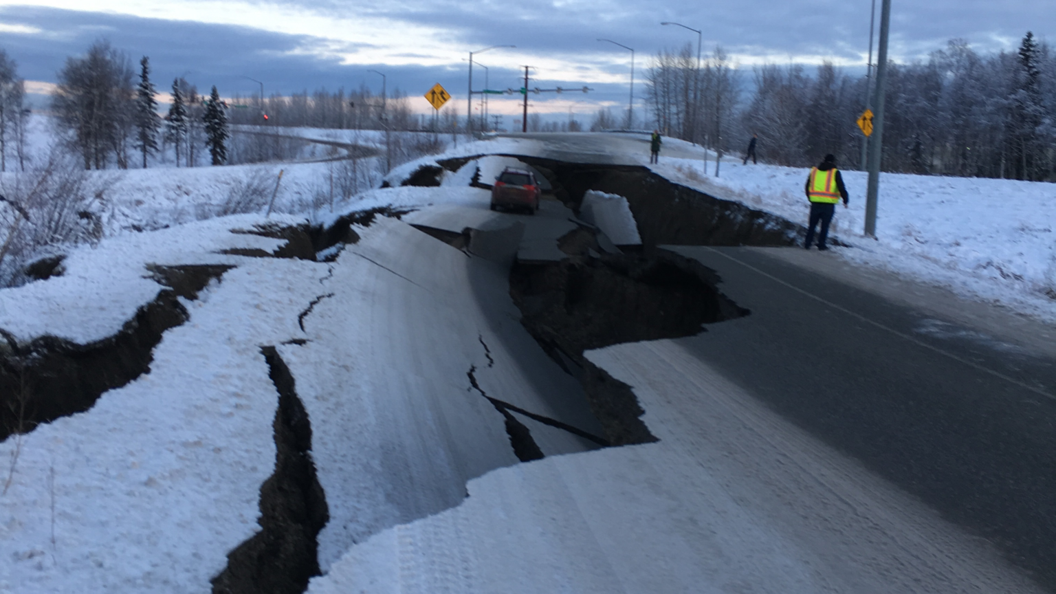
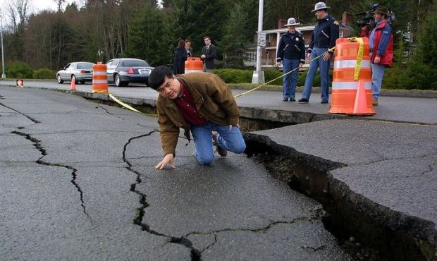
According to a recent map from the US Geological Survey (USGS), California faces a probability of over 95% of experiencing a damaging earthquake over the next 100 years.

Although California is especially vulnerable, the map indicates that almost 75% of the United States could encounter potentially harmful earthquakes and significant ground shaking, posing a threat to the lives of hundreds of millions of people in the coming century, reveals a new U.S. Geological Survey map.

Mark Petersen, USGS geophysicist and lead author of the study, said in a statement: 'Earthquakes are difficult to forecast but we've made great strides with this new model.

'The update includes more faults, better-characterized land surfaces, and computational advancements in… pic.twitter.com/8I4cMUXAru

— The Last_One (@The_Last_Tru) January 17, 2024

The team, consisting of over 50 scientists and engineers, spearheaded the development of the latest USGS National Seismic Hazard Model. This model utilizes a color-coded map to indicate areas in the country where damaging earthquakes are most likely, drawing insights from seismic studies, historical geological data, and cutting-edge data-collection technologies.

Then Governor Gary Locke inspects a severe crack in Deschutes Parkway in Olympia after the magnitude 6.7 Nisqually quake in 2001. (AP archive photo by Lauren McFalls)

The updated model suggests that California and Alaska, both historically prone to seismic events, may experience a higher intensity of shaking. On the East Coast, major cities such as Washington D.C., Philadelphia, New York, and Boston could potentially face more severe earthquakes than previously anticipated.

The study brought to light that 37 U.S. states have encountered earthquakes with a magnitude exceeding 5 in the last two centuries, underscoring a prolonged history of seismic activity throughout the nation. This model marks the initial comprehensive assessment of seismic hazards for the entire country and serves as an enhancement to the previous version released in 2018.

“The update includes more faults, better-characterized land surfaces, and computational advancements in modeling that provide the most detailed view ever of the earthquake risks we face,” said Mark Petersen, USGS geophysicist and lead author of the study, in a press release.

New map reveals the earthquake hotspots in the US

Hundreds of millions of Americans are at risk from damaging earthquakes, with a new map revealing that almost 75% of the country is in a danger zone. The US Geological Survey (USGS) made the discovery following its latest… pic.twitter.com/Dyr3pXxQ3s

— ZetaTalk Followers: Watch X, Planet X, aka Nibiru (@ZT_Followers) January 18, 2024

Describing the updated model as a “significant milestone in improving public safety,” he emphasized its pivotal role in guiding the future of architectural and structural design. The insights provided by this model are crucial for architects, engineers, and policymakers, shaping the planning and construction of structures throughout the country.

While predicting earthquakes remains a formidable task, the USGS underscores that studying faults and past seismic events enables scientists to better gauge the probability and potential intensity of future earthquakes.

You Might Also Like

Donald Trump Unveils $5 Million Trump Gold Card: Grants U.S. Residency and Exclusive Perks

Trump’s New Tariffs Ignite Backlash from US Business Leaders

Trump Hosts Iftar Dinner at White House, Thanks Muslim Americans for Their Support

US Health Agencies Set for Major Job Cuts and Restructuring

Major Data Breach Exposes Personal Information of Trump’s National Security Team

Jake Miller January 19, 2024 January 19, 2024
Popular News
ukraine-war-accountable-for-around-150-million-tons-of-co2-emissions-experts
Europe

Ukraine war accountable for around 150 million tons of CO2 emissions: experts

Jake Miller Jake Miller December 5, 2023
Donald Trump says Taylor Swift “pay a price” for endorsing Kamala Harris, prefers Brittany Mahomes
Tom Cruise and Ana de Armas Fuel Romance Rumors With New Public Sighting
Diddy’s Lawyers Demand Unshackled Appearance Ahead of Court Hearing
Prince Harry announces UK as the hosting nation for the Invictus Games 2027

Categories

  • Market
  • Tech
  • Fitness
  • Food
  • Celebrity
  • Fashion
  • Beauty
  • Football
  • Cricket
  • Entertainment
    • Celebrity
    • Movies
    • Television
  • Style
    • Arts
    • Beauty
    • Fashion
  • Health
    • Fitness
    • Food
  • Sports
    • Baseball
    • Basketball
    • Cricket
    • Football
    • Olympics
  • Business
    • Market
    • Tech
Useful Links
  • About us
  • Privacy policy
  • Term Of Use

2023 © Distinct Post News & Media. All Rights Reserved.

Welcome Back!

Sign in to your account

Lost your password?