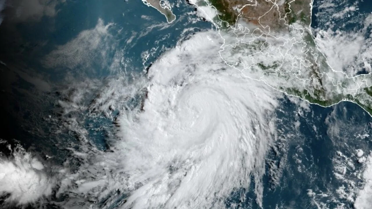
California is bracing itself for an extraordinary meteorological event – the imminent arrival of the first tropical storm to hit the state in an astonishing 84 years. Hurricane Hilary, born from rapid intensification in the Pacific Ocean southwest of Mexico, is predicted to bring heavy rainfall and the potential for flash flooding to the region, marking a historic occurrence that has left both residents and officials on high alert.
The last time California experienced the impact of a tropical storm was all the way back in 1939. This long gap between such events makes the impending landfall of Hurricane Hilary a significant moment that has captured the attention of the entire state. The storm’s rapid strengthening and progression have prompted preparations along the California coastline for the potential significant impacts it may bring.
While the hurricane is anticipated to weaken before reaching land, the primary concern remains its rainfall. Meteorologists are forecasting the possibility of several months’ worth of rain falling within a short period, thus escalating the risk of flash floods and related hazards. Local authorities have taken proactive measures in response, issuing flood warnings and advising residents to be well-prepared.
The projected path of the storm places the coastal areas, particularly Southern California and the Southwest region, at the greatest risk. This scenario has led experts and scientists to highlight the unusual nature of this event, especially considering that the West Coast is not the typical location for tropical storms and hurricanes. Such weather systems are usually associated with the East Coast or the Gulf of Mexico.
The potential effects of Hurricane Hilary stretch beyond immediate flooding risks. The copious rainfall could offer some relief to the region, which has been grappling with severe drought conditions. This rainfall could help replenish water supplies and recharge groundwater levels, providing a much-needed reprieve from the ongoing water crisis.
Furthermore, the increased cloud cover and precipitation are expected to lead to a significant drop in temperatures. This respite from the scorching heat that has been plaguing the region in recent months will undoubtedly be welcomed by residents.
According to forecasters at the National Hurricane Center, there is a cautionary note that Hilary could escalate into a Category 4 hurricane, boasting sustained winds exceeding 130 mph. The current position of the hurricane, around 500 miles south-southeast of Cabo San Lucas, Mexico, has already generated maximum sustained winds of 105 mph.
As Hilary progresses northward along Mexico’s Baja Peninsula, any shifts in its path could significantly influence where the heaviest rain and strongest winds are distributed across the United States. The rainfall from the storm could potentially commence as early as Saturday in certain parts of the Southwest, with California potentially experiencing the greatest impacts on Monday.
The looming threat of mudslides and flash flooding is coupled with a general expectation of 3 to 6 inches of rain across Mexico’s Baja Peninsula, particularly in elevated areas. Despite the expectations of Hilary’s weakening as it nears Southern California and the Southwest, the risk of substantial flooding remains a pressing concern.
Southern California, as well as southern Nevada, faces the possibility of widespread rainfall amounts ranging from 2 to 4 inches between Saturday and Monday. The most intense deluges are predicted for Sunday and Monday, with certain locales within this region potentially experiencing even higher levels of rainfall, up to 6 inches.
Furthermore, parts of Arizona, Central California, and northern Nevada could witness rainfall ranging from 1 to 2 inches. The cumulative effect of heavy rainfall over multiple consecutive days elevates the flood threat, as the soil’s capacity to absorb moisture becomes increasingly limited.
In conclusion, California’s anticipation of its first tropical storm in 84 years, in the form of Hurricane Hilary, brings both apprehension and potential relief. While the state braces for the risks of flooding and other related hazards, the hope is that the storm’s rainfall will provide a much-needed solution to the ongoing water scarcity issue and offer respite from the sweltering temperatures that have persisted. As the storm’s path unfolds, experts and residents alike are watching closely to see how this rare meteorological event unfolds.


