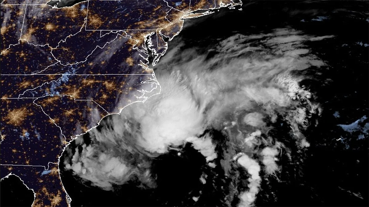
Tropical Storm Ophelia is making headlines as it rapidly gains strength off the East Coast of the United States, sparking heightened concern and preparations across the region. With maximum sustained winds reaching 70 mph and gusts even more powerful, Ophelia is poised to impact areas well beyond its immediate path, ushering in heavy rainfall and strong winds. In this article, we explore the latest developments regarding Tropical Storm Ophelia and the precautions being taken in anticipation of its arrival.
A Potent Storm Approaches: Tropical Storm Ophelia’s intensification has raised alarms as it progresses north-northwest toward the East Coast at an approximate speed of 13 mph. The storm’s potency has prompted meteorological authorities to issue a hurricane watch for specific areas along eastern North Carolina’s coastline. Ophelia’s center is anticipated to approach North Carolina’s coast on Friday night, potentially presenting significant challenges for residents in coastal areas.
The Path Forward: While there is a possibility that Ophelia could veer perilously close to the warm waters of the Gulf Stream, a scenario that might lead to further strengthening, the most likely outcome remains a deluge of heavy rain and formidable winds as the storm advances towards eastern North Carolina.
Coastal Areas on Alert: Coastal regions are bracing for the brunt of Ophelia’s impact, including heavy rainfall, strong winds, and the potential for power outages. The gravity of the situation has prompted North Carolina Governor Roy Cooper to declare a state of emergency for the entire state, ensuring that emergency response teams are poised to act with swiftness and efficiency.
Warnings and Preparations: Tropical storm warnings have been issued along the coast, stretching from just south of Charleston, South Carolina, up to the Maryland-Delaware state line. Furthermore, storm surge warnings extend from Surf City, North Carolina, to the Chesapeake Bay, emphasizing the need for thorough preparations.
Beyond the immediate concerns of heavy rain and strong winds, the region is also on alert for the potential development of tornadoes, particularly along the coastal mid-Atlantic.
Rainfall Predictions: Eastern North Carolina and southeast Virginia are expected to experience the most significant rainfall, with forecasts indicating 3 to 5 inches of rain. Isolated areas may receive up to 7 inches due to concentrated thunderstorm bands. Residents in the mid-Atlantic to southern New England should also remain vigilant, as 2 to 4 inches of rainfall are anticipated from late Friday through the weekend.
Coastal Challenges: Coastal areas should be prepared for hazardous storm surge, coastal flooding, rip currents, and rough surf. Surge levels ranging from 1 to 5 feet are possible in various areas, particularly in inlets and rivers from Surf City, North Carolina, to Manasquan Inlet on the New Jersey shore.
Exercise Caution: With the highest risk of storm surge flooding coinciding with Saturday’s high tides, areas from New Jersey to the Virginia Tidewater are strongly urged to exercise caution. Flood gauges across the region are projected to reach moderate or major flood levels on Saturday, underscoring the potential for coastal homes and businesses to flood and for roads to become impassable.
As Tropical Storm Ophelia gathers strength and bears down on the East Coast, residents and authorities are taking proactive measures to mitigate the potential impact. Vigilance, preparedness, and heeding official warnings are key to safeguarding lives and property as the region confronts this formidable weather event.


